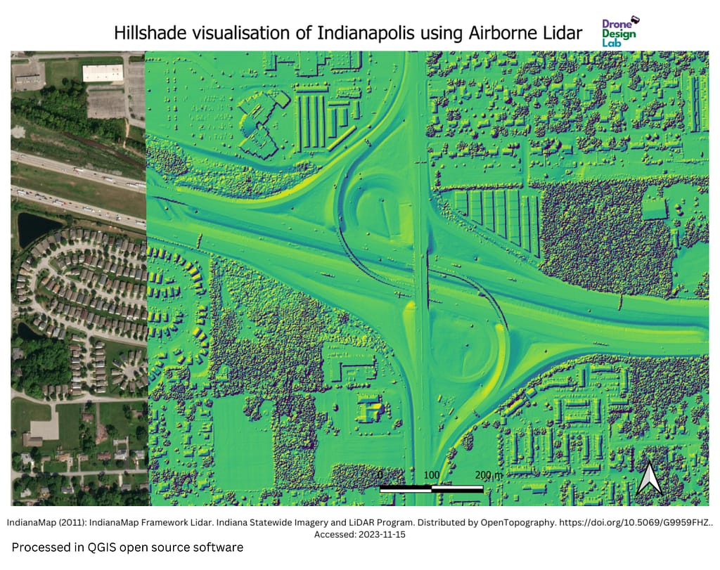
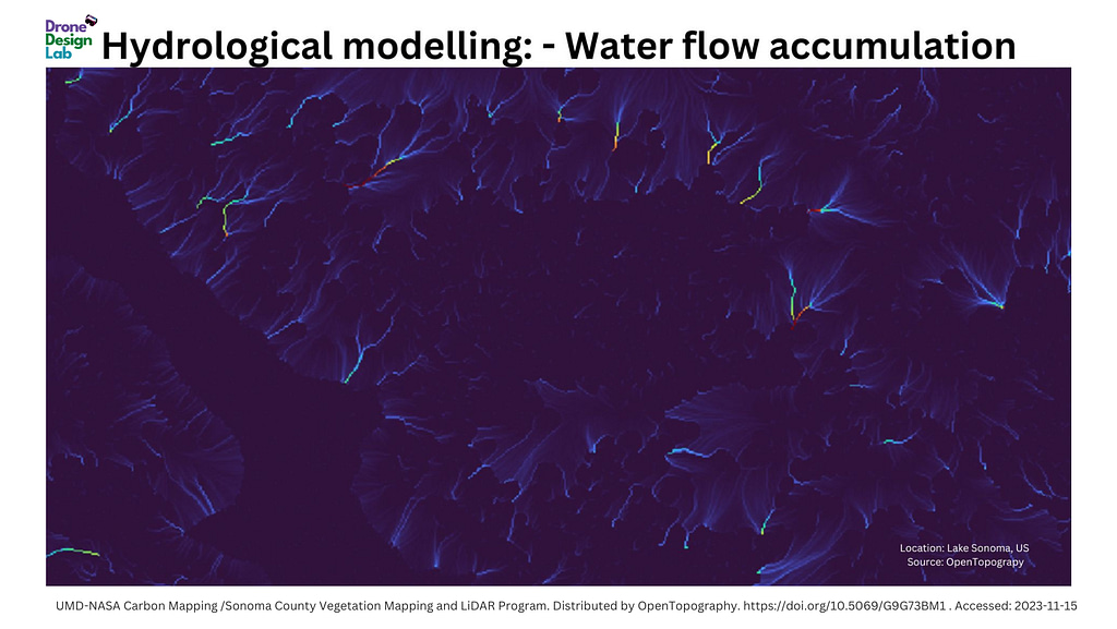
Remote Sensing Bring your data, we take care of the rest - Collaborate with us Hire us to hold UAV webinars:Career opportunity in the drone industryDrone social engagement on exhibitions/fairsOnline drone workshopsDrone service collaborationProject works:Georeferencing 3D printable model Digital Elevation Model Canopy height Model Private workshops:Train your employees to be a drone pilotTrain your employees about drones use cases LiDAR data use cases for informing citizens and municipalities: Assessing tree risks to residential propertiesModelling land services like soil and water pollution mitigationMapping risks to utility infrastructure such as power linesCreating and analyzing forest inventoryMultispectral remote sensingHyperspectral data analysis Military mapping Thematic mappingHydrographic mappinge-Government (future feature)National Spatial Data Infrastructure (Future feature) BOOK Appointment Are you interested to collaborate with us? Please fill in your information and we will contact you. Please enable JavaScript in your browser to complete this form.Your name *Email *Single Line Text *Single Line Text *Single Line Text *GDPR Agreement *I consent to having this website store my submitted information so they can respond to my inquiry.NameSUBMIT Read about our GDPR policy and privacy notice here Do you want to give away your drone to those who need it? Contact Us